
Navigation and Safety
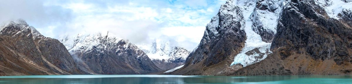
Hiking in Greenland will likely be quite different to hiking in your home country. Do not expect obvious paths, infrastructure, and cell phone reception – that’s not how things work here. We are #naturebeings. And while this makes unplugging and enjoying nature very easy, it also means that you must take navigation and safety seriously before setting out.
You hike our trails at your own risk, so please make sure you have sufficient experience and the correct equipment.

Navigation
All of the trails on this website are clearly marked – usually with blue paint on stones (red for the Arctic Circle Trail), but occasionally with sticks or cairns.
You should have no problems following the routes, but we recommend you also download the trail descriptions of the different hikes you plan to do in each town.
You can also download the GPX track for each hike from the relevant page on this website.
Maps
For those looking for physical maps, there are Greenland hiking maps for Kangerlussuaq, Maniitsoq, and Sisimiut that you can purchase from your favourite online map store. You may also be able to buy them once you have arrived in town, but this is not guaranteed.
Note: these may not be updated with latest trail information and the resolution is not as good as one would like for a hiking map.
If you plan to hike further afield, you may also need the Pingu map (between Kangerlussuaq and Sisimiut) or the Evighedsfjorden or Apussuit map (near Maniitsoq).
Larger scale maps that cover the region are the Arctic Sun Maps. While these are great for an overview of each area, there is not enough detail for them to be used as a full navigation aid.
Safety
Although the trails are well marked, those that do not follow roads (near Kangerlussuaq) are not well travelled. Do not expect nice, well-formed paths where you can hike side-by-side with a buddy.
At best, you will have a foot-width track to follow. But often you will find yourself navigating from marker to marker over rough ground. On some hikes, you will have to boulder scramble or do some low-risk climbing. And on a very few hikes, there is equipment installed to assist you.
Please read the trail descriptions on this website carefully before choosing which hikes you want to do.


What to be cautious of while hiking
The key safety things to be mindful of are as follows. You can also read more about staying safe in Greenland at:
- How to travel safely in Greenland
- Natural Hazards in Greenland
- How Search & Rescue works in Greenland
Weather
This is very important. Weather in the Arctic is extremely changeable so even if you are only going out for a few hours, you must be prepared. See our What to take on your hike page for more information.
If you are hiking to the top of a mountain and you can see the weather changing, start to descend immediately. Once the peak is covered in cloud (fog), it is much more difficult to find your way back down when only following markers.
Wildlife
The further you get from a town or settlement, the more likely you are to encounter wildlife. If you keep a sharp eye out and hike quietly, you may come across musk oxen (near Kangerlussuaq and Sisimiut), reindeer, arctic hare, arctic foxes, ptarmigan (a type of grouse) and other birdlife.
These animals generally try to avoid close contact with humans and, while not usually dangerous, we strongly advise you to maintain a distance of at least 100m if you come across them. This means no feeding, petting, or otherwise disturbing the animals to get a photograph for social media.
Regarding Polar Bears, they are extremely rare in the Arctic Circle Region. For this reason, we do not recommend you hike with a rifle or bear spray.
You can read more about the different types of animals you might encounter on our Wildlife page for the Arctic Circle Trail.

In case of emergency
If you need the police, please contact the them on: +299 701448
While hiking, we strongly encourage you to go with at least one other person or join a group. This is much safer than hiking alone.
Each time you head out hiking (even with a buddy), you should let someone (reception at your accommodation) know where you are going, which route you are taking, and when you plan to return. Then check in again upon your return to let them know you are safe. Ideally, you would also carry a Personal Locator Beacon (PLB) with two-way communication capabilities.
Read more about what happens when you activate an emergency beacon on the ACT. Please be honest with your experience level and whether it is appropriate for the trail.
We have a limited number of PLBs for hire for those hiking the Arctic Circle Trail. However, if you would like to do a lot of remote hiking in the region and do not have your own PLB, you can always contact us to discuss.